Public Works
Maintenance & Development

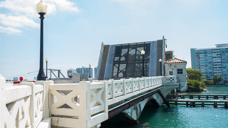
The County maintains approximately 5,500 miles of dedicated public roads, approximately 195 vehicular or pedestrian bridges and approximately 168 miles of secondary canals.
The Department of Transportation & Public Works (DTPW) operates the toll plazas on the Rickenbacker and Venetian Causeways.
Learn about new reconstruction and improvements to existing roadways, traffic signals, sidewalks and bridges throughout Miami-Dade County.

The information available in this search has been assembled for the use of Miami-Dade County for the design and development of Public Works projects.

Review current and revised Standard Details to ensure projects meet requirements in accordance with applicable engineering standards.

The Stormwater Utility was established in 1991 to properly manage the environmental impact of stormwater pollution and to provide adequate flood protection.
About Us
The Department of Transportation and Public Works (DTPW) develops, coordinates and operates the County transportation networks with the goal of improving ability to create a safer, more resilient, connected and sustainable community for our residents, businesses and visitors.
The Department of Transportation and Public Works (DTPW) keeps the County moving by connecting people, communities, and opportunities through a world-class transportation network. Our mission is to deliver safe, reliable, and efficient public transportation services while building and maintaining the critical infrastructure that supports the growing and vibrant communities of Miami-Dade County.
As part of DTPW's mission, the department operates, repairs, and maintains a myriad of public infrastructure assets throughout Miami-Dade County, including:
- 16 million linear feet of sidewalk in unincorporated Miami-Dade County
- 3,154 traffic signals - fourth largest network in the country
- Over 1,250,000 traffic signs
- Over 3,150 miles of paved roads throughout unincorporated Miami-Dade County
- 27,668 streetlights
- Nearly 400 miles of dedicated bicycle lanes and trails for cyclists and pedestrians countywide
- Over 51,500 drainage structures
- 199 vehicular bridges, including 8 movable bridges and 9 culverts
- 14 pedestrian bridges
- More than 209 miles of secondary canals and ditches
- 18 pump stations
Residents can report certain neighborhood improvement concerns below by calling 311 or using 311Direct.